Contesting trade and empire in an eighteenth-century depiction of the island of Hormuz

In contemporary geopolitics, the Strait of Hormuz, giving access from the Indian Ocean to the waters of the Persian Gulf, constitutes a pinch point of global maritime commerce. Super tankers and flows of oil transit through this narrow passage, dominated by the rugged mountains of the Ras Musandam peninsula. The way that this terraqueous space operates as a vital conduit and nexus of the world economy might seem to be a relatively novel phenomenon, and one specifically born out of how over recent decades oil and petroleum products have become linchpins of global trade. Yet in many respects this global salience of Hormuz is nothing new. For centuries, Hormuz — both the Strait itself and the eponymous island of Hormuz, located on its northern side — have held a key position at the crossroads of the Persian, Arabo-Ottoman, and Asian worlds, as well as being a site where different European powers sought to leverage a role for themselves.
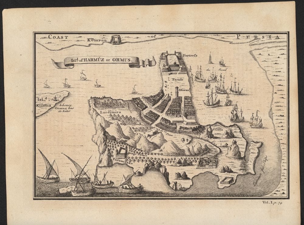
Longstanding historical interest in and contestation of Hormuz is reflected in how the site has been represented in a wide range of textual and visual sources. One revealing example of this is a mid-eighteenth century British depiction of Hormuz titled “A Prospect of the Island of Ormus” (Fig. 1), which was published as an engraving in Thomas Astley’s A New General Collection of Voyages and Travels: Consisting of the Most Esteemed Relations, Which Have Been Hitherto Published in Any Language (1745–47 [Fig. 2]). This anonymous engraving appeared in tandem with a chapter-length segment of Astley’s book, with this text narrating the expansion of the Portuguese empire in Asia and across the Indian Ocean World, and the role of Hormuz in the rise and fall of this Portuguese imperial and trading power.
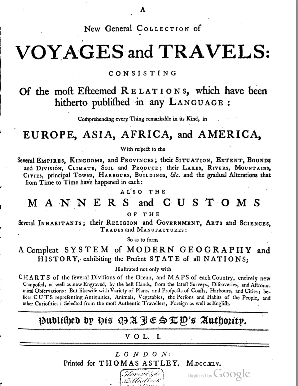
Astley’s multi-volume New General Collection of Voyages and Travels is a travel compendium, a genre that flourished in Europe in the seventeenth and eighteenth centuries. It aimed at summarizing European “discoveries” since the fifteenth century, beginning with the Portuguese exploration of the West coast of Africa and ending with eighteenth-century voyages in China. John Green was the editor while Astley was in fact the publisher and at the same time the owner of the book collection which from which many of the texts used in the New Collection of Voyages and Travels would be drawn. Unlike his illustrious predecessor Richard Hakluyt, who in the early seventeenth century had authored The Principal Navigations, Voyages, Traffiques and Discoveries of the English Nation, Astley did not just create an anthology, assembling first-hand voyage accounts. Rather, he sought to compile narrative accounts wedded into a sequential whole, and enriched with maps, tables, charts, and engravings, while also listing previous publications on the regions described. Astley’s project would in many ways set a new standard for this kind of endeavour, and one which would in turn influence subsequent other publication projects along similar lines: for example, A New General Collection of Voyages and Travels would become a model for the abbé Prevost’s fifteen-volume Histoire générale des voyages, published in Paris between 1746 and 1759.
The engraving “A Prospect of the Island of Ormus” is interestingly hybrid in its formal aspects: at one level the image presents as a kind of map, and yet it also has elements of pictorial representation. The historical conjunction evoked is that of Hormuz around the time of the Portuguese domination of the island. Some of the topographical labelling shown involves Portuguese references: for example one church or chapel shown on the island is labelled “Santa Lucia”, and the name of one prominent street is given as “de la Pena”. At the same time, though, other labels point to how the island and its features were a palimpsest of different populations and successive political authorities, notably with a tower or minaret marked “Alkoran”.
As the pages of text accompanying the image describe, Hormuz, which was at the beginning of the sixteenth century an independent kingdom, was conquered by Alphonso di Albuquerque in 1514, after an initial unsuccessful attempt seven years earlier. The invasion fleet had departed from Goa, which had been the centre of Portuguese India since 1510. The assault on Hormuz was part of a larger plan designed by the King of Portugal, Manuel, I to control the trading routes of the Western and Eastern Indian Ocean. For this endeavour to succeed, the Portuguese aimed at positioning themselves so as to dominate critical terraqueous locations throughout this vast region, with the sites they targeted encompassing islands, coasts, inland seas and maritime straits. Alfonso de Albuquerque had failed to capture Aden in 1513, whose conquest would have permitted gaining control over the flows of goods transiting through the Bab-el-Mandeb Strait, which connects the Red Sea with the Arabian Sea. But he nonetheless did manage to obtain a prominent position for Portugal in the trade with Egypt, the Red Sea, Arabia and Persia by establishing commercial outposts in Oman and on the island of Socotra in 1507. Bahrain also fell within the Portuguese sway in 1514, reinforcing Portugal’s position in the Persian Gulf. Further East, Malacca had been conquered in 1511, leaving the Portuguese in command of commercial exchanges with China and the Indonesian archipelago.
The control of Hormuz was a vital part of this larger vision. Capturing the island gave the Portuguese a vantage point onto the overland and maritime trading routes connecting Europe with the Middle East via the Eastern Mediterranean, through Basra, Tripoli, Baghdad, and Aleppo. The island itself was relatively barren, but as a trading post it had long been a flourishing entrepot: and, for a period, it would flourish anew under Portuguese rule. Valuable commodities such as silk, Arabian horses, wood from India, Persian silk, dates, pearls, coral, spices and even Chinese ceramics and porcelains transited through this hub. Hormuz became a site of cross-cultural encounters between Portuguese, Armenian, Ottoman, Arab, Indian and Persian merchants.
The engraving from Astley’s New General Collection of Voyages and Travels also, though, evokes how the fate of Hormuz changed suddenly in 1622 — and in a way which highlighted the larger region’s changing geopolitics. In Persia, Shah Abbas, who had been in power since 1588, was at this period conducting reforms which aimed at reinforcing and centralizing the Safavid state. Portuguese commercial and political might in Oman and Hormuz would become a major target of Shah Abbas’s efforts to establish Safavid sovereignty in the waters of the Persian Gulf. In this effort, he found an ally in the shape of another interloper European power in the region, namely England’s recently-established East India Company. A small flotilla of East India Company shipping gave logistical and military support to Shah Abbas in his endeavour to expel the Portuguese from Hormuz, and the resulting joint Perso-English expedition bombarded the fort of Hormuz, sank the Portuguese fleet, and besieged the island for several weeks before its surrender in May 1622. More than two thousand Portuguese inhabitants were expelled to Muscat. This event marked the effective end of the island of Hormuz’s longstanding role as a flourishing entrepot.
The 1745 engraving of Hormuz published in Astley’s account was probably based on a Dutch map, which in turn drew on Portuguese representations of the island. European maps in the early modern may be said to have functioned as a kind of collage. Cartographers frequently drew on and borrowed from existing maps, nautical charts, pictorial representations and plans, and reproduced or recast these in new forms. In doing so, they relayed information which might be of questionable unreliability, but which is itself revealing in terms of the sourcing and transmission of forms of knowledge. European commercial and political European commercial and political expansion in the Indian Ocean World and in Asia was accompanied by a huge map-making and surveying enterprise. Visual representations, reports and geographical treaties and plans located navigation and trade routes, resources, and opportunities. They also mapped the changes brought to the worlds of Asia by Europeans: these included the opening of trading stations or ‘factories’, the building of ports and shipyards, and the creation of new urban settlements structured around religious missions, churches, and botanical gardens.
But what the visual and textual narratives about Hormuz contained in Astley’s work suggest is that spatial representations shape reality and history more than they reproduce it. In this case, what we see is perhaps best understood as a tracing of a British imperial imaginary about the island in the eighteenth century. In this sense, Hormuz is pictured as a contested nexus of trade, between the rulers of the once independent kingdom of Hormuz, the Portuguese, the Safavids — and the British. In the final analysis, the engraver of this map would seem to have sought to reference, but in some ways also to supersede, the Portuguese history of the island. Thus, while Portuguese references denote some of the topography of this long-contested fortified site, English emerges here as the framing language, and is used also to designate places such as “the King’s palace” or to identify “St John” and “St Custin” Streets. The map and Astley’s text — which, after having described the fall of Portuguese outposts in Asia such as Hormuz, then goes on to narrate the dawn of the British empire through exploratory expeditions in Africa in the sixteenth century — further suggests that the British saw may be said to be situating themselves as the natural successors both to European empires and to local potentates, whose various histories are still visible in the ruins.